LUBBOCK, Texas -
9:00PM Update: - The severe thunderstorm watch has been canceled as all the storms have exited the region to the southeast. A few isolated light showers could continue overnight, but for the most part we will be done with the storms until late Saturday. Get the rest of the forecast in the original blog post below.
update 5:52 p.m. - We had some small hail and heavy rain move over central and east Lubbock earlier this evening. There have been scattered storms over the western South Plains. At times there may have been some 1" hail, but most recently storms have behaved themselves below severe limits. It looks like the greater coverage of storms is developing over the southeastern Panhandle...and farther northeast all the way up into the Midwest. Next few hours the most widespread coverage will likely be over the eastern part of our area.
Through 7 p.m. we'll have some storms moving close to Lubbock. These could pulse up to 1" hail and 60mph gusts, though latest trends suggest they'll be a little weaker.
Severe watch continues until 11pm.
Interactive radar
FOX 34 VIPIR live stream


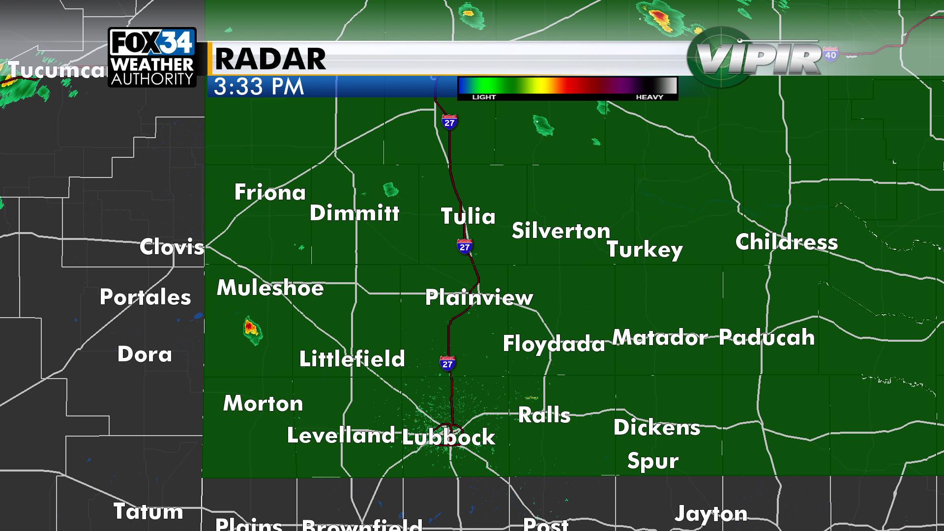
update 3:38 p.m. - A severe thunderstorm watch is in effect until 11 p.m. for Lubbock and most of the South Plains. This means any storm that develops rest of today has the potential to produce large hail and damaging wind. The severe thunderstorm watch is shown in green below, roughly along and north of Highway 114.
STORM POTENTIAL: At mid-afternoon some storms have been developing across the higher terrain of New Mexico. These storms are moving east. Short-term models also show some storms should develop from the Texas Panhandle up into SW Kansas. It’s also warm and humid enough that a few isolated storms could go up in our area. But it looks more likely that a cap, or warmer air aloft, will limit storm development here through the afternoon.
THIS EVENING: We’ll first need to watch if any storms can pop up within our area. We’ll also be watching to the north. Most computer model runs shows storms up over the Panhandle will move south into our area. Any storms that develop will have the potential to become severe with up to golf ball-size hail and 65mph wind gusts.
TONIGHT: There is a chance for a few more showers or storms, low in the upper 50s.
HIGHER RAIN CHANCE: A few factors will come together for a pretty good setup for rain. The one certainty is it’ll get much cooler Saturday and Sunday. A cold front will move through in the morning and will likely stall somewhere south of Lubbock. Provided the front does wind up south of the city it’ll only reach the low to mid 60s in Lubbock with mid 70s along Hwy 180 from Hobbs to Lamesa. The high will only reach the upper 50s north of Lubbock.
Showers and storms are likely in the morning, as the front moves across the area. While we could see a few showers later in the day, the higher likelihood is tomorrow morning. It’ll stay cloudy.
Late tomorrow night into Sunday some rain is likely. The rain chance will fade by late Sunday.
Some locally heavy rain will be possible. Common totals of around 1/4” to 1/2” can be expected. But this kind of setup suggests some 1”+ totals. Hopefully this pans out, we need the rain. Because it’ll be cooler the severe weather threat is low tomorrow and Sunday.
NEXT WEEK: Monday will be warm, dry and breezy with the dry line somewhere east of Lubbock. Humidity will return to the region bringing a slight chance for storms each afternoon Wednesday and Thursday.

Check back here for updates. Christopher will have the next full forecast update Saturday afternoon.
-Matt