LUBBOCK, Texas -
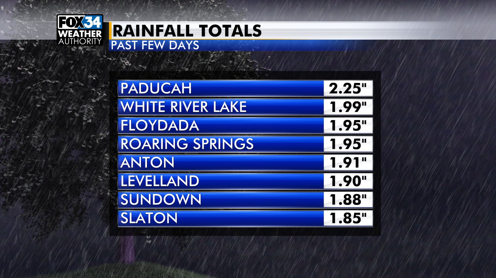
MORE GOOD RAIN: The round of showers and thunderstorms last night into early this morning brought some more good soaking rain. In fact, after 0.75" of rain yesterday at the Lubbock airport we're now 0.16" below the YTD average. That deficit was more than 2.5" earlier this month. This has been great for the area. Here are the top totals in our area past few days off of the Texas Tech Mesonet:
 ?
?
TODAY: Cloudy this morning with some breaks in the clouds by the afternoon, high 67, wind NE-SE 5-15mph. There is just a slight chance for a shower or storm.

TONIGHT: Clouds will increase, some fog is possible by morning, low near 53.
NEXT FEW DAYS: It will get warmer, near 80 tomorrow, mid 80s Saturday and Sunday. It's also going to get more humid. While we'll have some humidity in place tomorrow it doesn't look likely that storms will form because an upper-level ridge will be overhead. That higher pressure should keep it dry.
Things do change this weekend. We see a slight chance for storms late on Saturday, then a better chance Sunday. We're watching the potential for a few severe storms Sunday. The main risk is large hail. By Monday the dry line will probably move well east of Lubbock, taking a slight chance for storms east to the Rolling Plains.
NEXT WEEK: It looks warmer by mid-week, back up close to 90. There will still be humidity in the region, but right now it looks like storms will be over Oklahoma and North Texas.

Have a great day. Rudy will update this forecast later today.
-Matt