LUBBOCK, Texas -
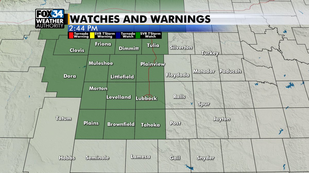
UPDATE: A Severe Thunderstorm Watch has been issued for much of the South Plains (counties in green below), including Lubbock, until 10 p.m.
ORIGINAL POST:
Here is a quick update early this afternoon. The forecast Rudy posted last night is still on track. We expect some thunderstorms later today and again tomorrow.
We’ll have a lot of humidity in place both days. Here is the current dew point map. 60s show good moisture. Combined with the temp in the 80s this will lead to moderate to strong surface instability.

Interactive radar
FOX 34 VIPIR live stream
The Storm Prediction Center has highlighted much of our area with a risk for severe storms. Because the lower-level wind field will be fairly weak, and moisture should drop off some later today, the tornado risk is quite low. We can’t rule out a brief tornado, but the main risk at this point is large hail and damaging wind.
Storms are expected to develop somewhere over the western South Plains after 3 p.m., slowly moving toward the central South Plains, including Lubbock, between 6-9p.m. Not every location will get a storm, but it’s a pretty good chance for everyone in our area to have a storm.
The severe risk looks higher tomorrow. There’s a big “if” to this. If we see showers and storms late tomorrow morning into early afternoon then the severe risk will probably be lower. Some computers show this early-morning activity. Provided we don’t see early-day rain, or if we do and it can clear out through the afternoon, here is the severe risk:
Because there will be more humidity, a more organized lower-level wind field, and better upper-level support, the risk tomorrow includes very large hail, damaging wind and the possibility of a few storms in the region. Again dependent on us not seeing storms early…the storm time line will be similar to today. The dry line will probably be a little farther east, which means storms would develop closer to US 385 or I-27/US 87, then build east. This would be some time after 2 p.m.
Remember when watches are issued it’s for the potential for severe weather. W
Christopher will have a full update to the forecast here later today.